


Cyclone Arnab crossed the Andhra Pradesh coast with winds gusting up to 150 kmph, bringing heavy rain, flooding risks and widespread disruption.
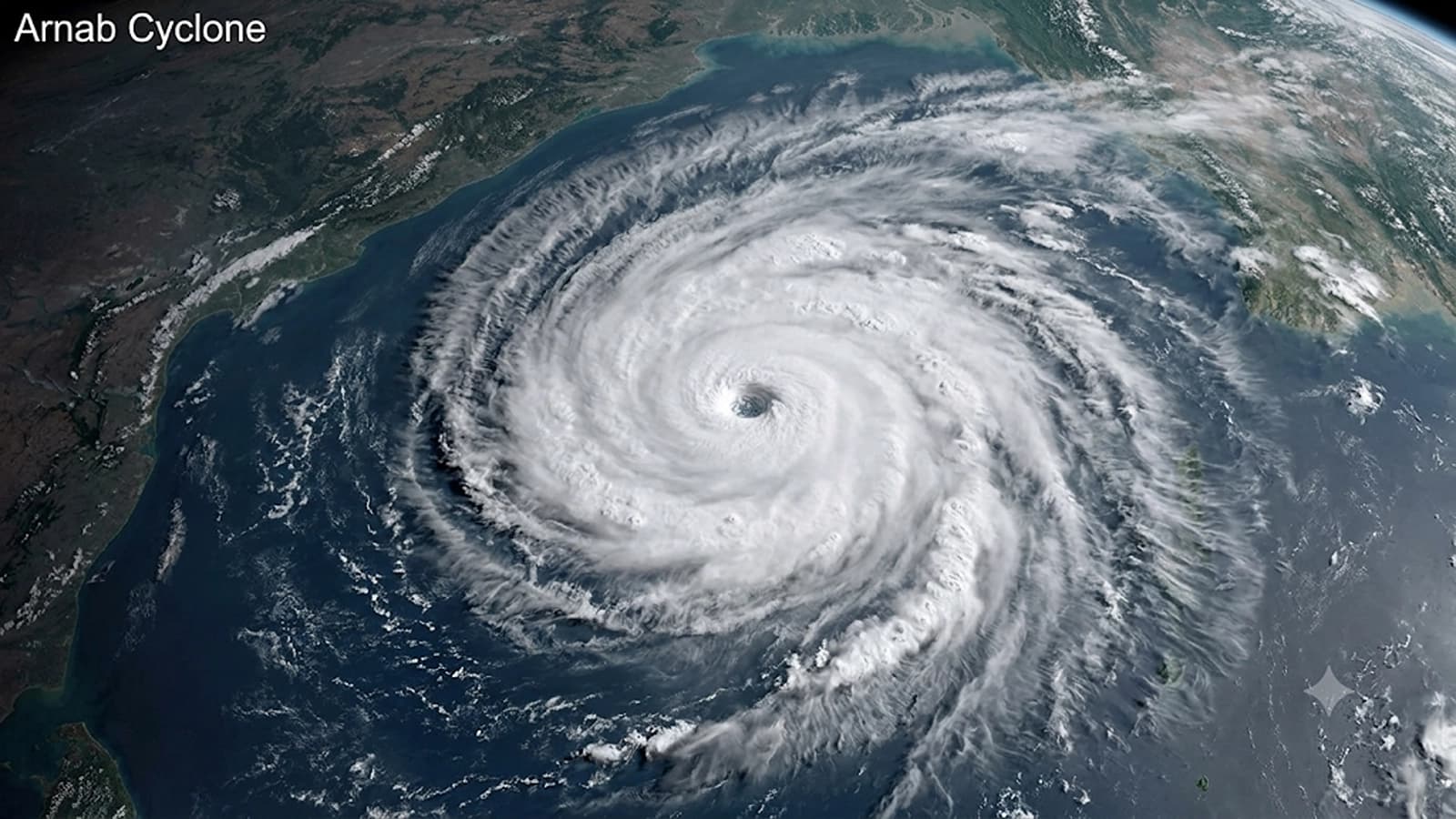
Representational Image
Cyclone Arnab, a powerful tropical storm that developed over the Bay of Bengal, crossed the Andhra Pradesh coast early Wednesday, October 28, bringing intense rainfall, strong winds and flooding risks to parts of eastern India.
The India Meteorological Department (IMD) confirmed that Arnab made landfall as a very severe cyclonic storm, with maximum sustained winds of 125–135 kilometres per hour and gusts reaching 150 kmph.

According to the IMD's 9:50 am bulletin, the landfall process had been completed, with the storm's central region moving entirely over land. Arnab weakened into a severe cyclonic storm by 8:30 am, although heavy rainfall and damaging winds continued across affected areas.
The cyclone has forced large-scale evacuations, disrupted transportation and raised concerns about coastal flooding, particularly in Andhra Pradesh and neighbouring Odisha.
Where did Cyclone Arnab make landfall, and which states are affected?
Cyclone Arnab crossed the Andhra Pradesh and Yanam coasts between Bapatla and Visakhapatnam, close to the south of Yanam in the Union Territory of Puducherry.
The storm developed from a low-pressure system over the Bay of Bengal, which intensified into a depression, then a deep depression, before becoming Cyclone Arnab on October 26. It subsequently strengthened into a very severe cyclonic storm as it moved towards India's eastern coastline.
Andhra Pradesh has experienced the most direct impact, with heavy rainfall reported in Visakhapatnam, Kakinada and surrounding coastal districts. Odisha has also experienced intense rainfall, particularly in its southern districts.
Rainfall figures reported by NDTV, citing the latest weather observations, show that Visakhapatnam received 315 mm of rain by 8:30 am on Wednesday, followed by Vizianagaram with 301 mm, Anakapalli with 275 mm, Srikakulam with 257 mm and Krishna with 223 mm. In Odisha, Koraput recorded 188 mm and Ganjam 161 mm.
The rainfall has been accompanied by uprooted trees, electricity disruptions and transport cancellations. Flights serving Visakhapatnam and Vijayawada were affected, while railway authorities cancelled or rescheduled several services.
Ahead of landfall, Andhra Pradesh authorities evacuated at least 89,000 people from vulnerable areas. Officials also established more than 2,000 cyclone shelters across 20 districts and secured over 30,000 fishing boats, according to the Associated Press.
No deaths had been reported in the initial assessments on Wednesday morning, although the extent of damage was still being assessed.
How did Cyclone Arnab form, and why was it so powerful?
Tropical cyclones develop over warm ocean waters when atmospheric conditions allow a low-pressure system to organise and intensify.
According to the IMD's cyclone forecasting guidance, sea surface temperatures above approximately 26.5°C, sufficient atmospheric moisture and low vertical wind shear are among the conditions that favour cyclone formation. Warm, moist air rises from the ocean surface, cools and condenses into clouds, releasing heat that helps the storm strengthen.
As atmospheric pressure falls, surrounding air moves towards the centre. Earth's rotation influences this movement, producing the rotating circulation associated with tropical cyclones.
The Bay of Bengal is particularly vulnerable to such systems during the post-monsoon period, especially October and November. Arnab developed during this period and became the first cyclonic storm over the Bay of Bengal in 2026.
The IMD classified Arnab as a very severe cyclonic storm before landfall. This classification is based on sustained wind speed, rather than rainfall or the storm's physical size.
Why is the cyclone named Arnab?
The name Arnab, pronounced Ornab, was proposed by Bangladesh. It appears in the list of tropical cyclone names adopted by the World Meteorological Organization (WMO) and the United Nations Economic and Social Commission for Asia and the Pacific (ESCAP) Panel on Tropical Cyclones in April 2020.
The list contains 169 names contributed by 13 countries, including India, Bangladesh, Pakistan, Sri Lanka and Myanmar. The names are assigned sequentially to qualifying tropical cyclones forming over the North Indian Ocean.
Arnab is commonly associated with the Bengali word for ocean or sea, although the official naming list does not specify its meaning.
The naming system helps meteorological agencies, governments and the public distinguish one cyclone from another, particularly when multiple weather systems are active.
Why does Cyclone Arnab remain dangerous after landfall?
A cyclone generally begins losing strength after moving inland because it is cut off from the warm ocean waters that supply much of its energy. However, weakening wind speeds do not necessarily mean the immediate danger has passed.
Heavy rainfall can continue for hours or days, causing flash floods, overflowing rivers, waterlogging and landslides in vulnerable terrain. Strong winds may also damage buildings, electricity infrastructure and communication networks.
Before Arnab's landfall, the IMD warned that a storm surge of approximately 1.5 to 2.5 metres above the predicted astronomical tide could inundate low-lying coastal areas of Andhra Pradesh, with the greatest risk near Kakinada and Yanam. A storm surge occurs when powerful winds and changes in atmospheric pressure push seawater above normal tidal levels.
The combined effects of rainfall, coastal flooding and strong winds can therefore persist even as a cyclone weakens. Residents in affected districts should follow updated IMD forecasts and local evacuation instructions rather than assuming that the completion of landfall means conditions are safe.
Authorities are expected to continue monitoring rainfall, flooding and infrastructure damage as the storm moves inland. The full human and economic impact of Cyclone Arnab will become clearer after assessments are completed.
Reporting status: October 28, 2026, approximately 10:40 am IST. Cyclone intensity, rainfall totals, evacuations and damage assessments may change as new bulletins are issued.

ULLAS 2026: Will B.Ed. Students' Academic Credits Depend on Adults Passing Literacy Tests?

Oxford researchers turn historic plant collection into a window on colonial science

Magnitude 5.1 Earthquake Strikes Near Andaman and Nicobar Islands; No Immediate Reports of Damage

Earth’s life story may not have begun with comets, new study finds

Can India's Biggest Examinations Become Leak-Proof?
ULLAS 2026: Will B.Ed. Students' Academic Credits Depend on Adults Passing Literacy Tests?
Earth’s life story may not have begun with comets, new study finds
Can India's Biggest Examinations Become Leak-Proof?

Less juggling for parents? Singapore to unite kindergarten learning and after-school care by 2030

Bihar’s NMCH suspends 146 students over ragging: Wake-up call for medical colleges

ULLAS 2026: Will B.Ed. Students' Academic Credits Depend on Adults Passing Literacy Tests?
Oxford researchers turn historic plant collection into a window on colonial science
Magnitude 5.1 Earthquake Strikes Near Andaman and Nicobar Islands; No Immediate Reports of Damage
Earth’s life story may not have begun with comets, new study finds
Can India's Biggest Examinations Become Leak-Proof?
ULLAS 2026: Will B.Ed. Students' Academic Credits Depend on Adults Passing Literacy Tests?
Earth’s life story may not have begun with comets, new study finds
Can India's Biggest Examinations Become Leak-Proof?
Less juggling for parents? Singapore to unite kindergarten learning and after-school care by 2030
Bihar’s NMCH suspends 146 students over ragging: Wake-up call for medical colleges
Copyright© educationpost.in 2026 All Rights Reserved.