An active spell of severe weather is set to sweep across India this week, with the India Meteorological Department (IMD) forecasting widespread rainfall, thunderstorms, gusty winds and hailstorms under the influence of multiple western disturbances and interacting atmospheric systems.
According to the latest advisory, the turbulent weather pattern will impact large parts of the country from March 30 to April 5, with peak intensity expected around March 30 and again on April 4.

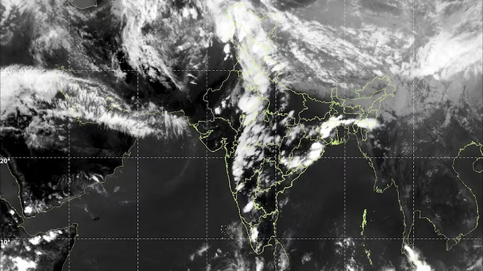
The IMD has warned that the Kashmir Valley could witness isolated heavy rainfall, while hailstorms are likely to lash northwest India on March 30. Central and eastern regions are expected to face similar conditions a day later, on March 31.
Rainfall activity is also set to intensify across northeastern and eastern India between March 31 and April 1, with several areas likely to receive heavy showers. In the south, thunderstorms accompanied by lightning and gusty winds are forecast to persist through the week, with Kerala expected to experience particularly heavy rainfall on March 31 and April 1.
The IMD attributed the volatile conditions to a complex interplay of meteorological systems. A western disturbance positioned over parts of north Pakistan and adjoining regions is extending across multiple atmospheric levels.
Simultaneously, cyclonic circulations over Punjab and northwest Uttar Pradesh, along with troughs stretching across central and eastern India, are pulling in moisture from both the Arabian Sea and the Bay of Bengal.
Over peninsular India, a trough in easterlies and a wind discontinuity line from Vidarbha to Tamil Nadu are further fuelling atmospheric instability, triggering thunderstorm activity. Additional systems over northeast Assam and eastern India are also contributing to the expected heavy rainfall.
In the past 24 hours, heavy rain has already been recorded in parts of Kerala, while hailstorms were reported from Haryana, west Madhya Pradesh and Madhya Maharashtra. Thunderstorms with gusty winds of 30–50 kmph were observed across several regions, including northeastern and peninsular India.
Temperature patterns are also expected to fluctuate sharply. Maximum temperatures over northwest India may initially dip by 2–4°C, rise by up to 5°C by April 3, and then fall again under the influence of another incoming western disturbance.
The IMD has advised residents to remain vigilant, warning that thunderstorms, lightning and hailstorms could disrupt normal life and pose safety risks in affected areas over the coming days.


.png&w=256&q=75)
.jpg&w=256&q=75)
.jpg&w=256&q=75)
.jpg&w=256&q=75)
